Targeted end-users
The SAFERS intelligent service "EO based fire delineation models" offers an on-demand capability to delineate and assess the severity of burnt areas using imagery from the Copernicus Sentinel-2 satellite and advanced artificial intelligence algorithms. It delineates the boundaries of burnt areas, estimates their relative severity, produces maps of fire fronts, and assesses the potential impact of fires.
The service enables end-users to request maps by specifying an area of interest and a period. It offers features such as automatic detection of burnt areas, creation of severity indices to assess impact, and estimation of the impact on affected infrastructures and inhabitants. Results are provided as standard geo-Tiff images that can be used in other GIS platforms.
Wildfire management phase: detection and response; adaptation and restoration.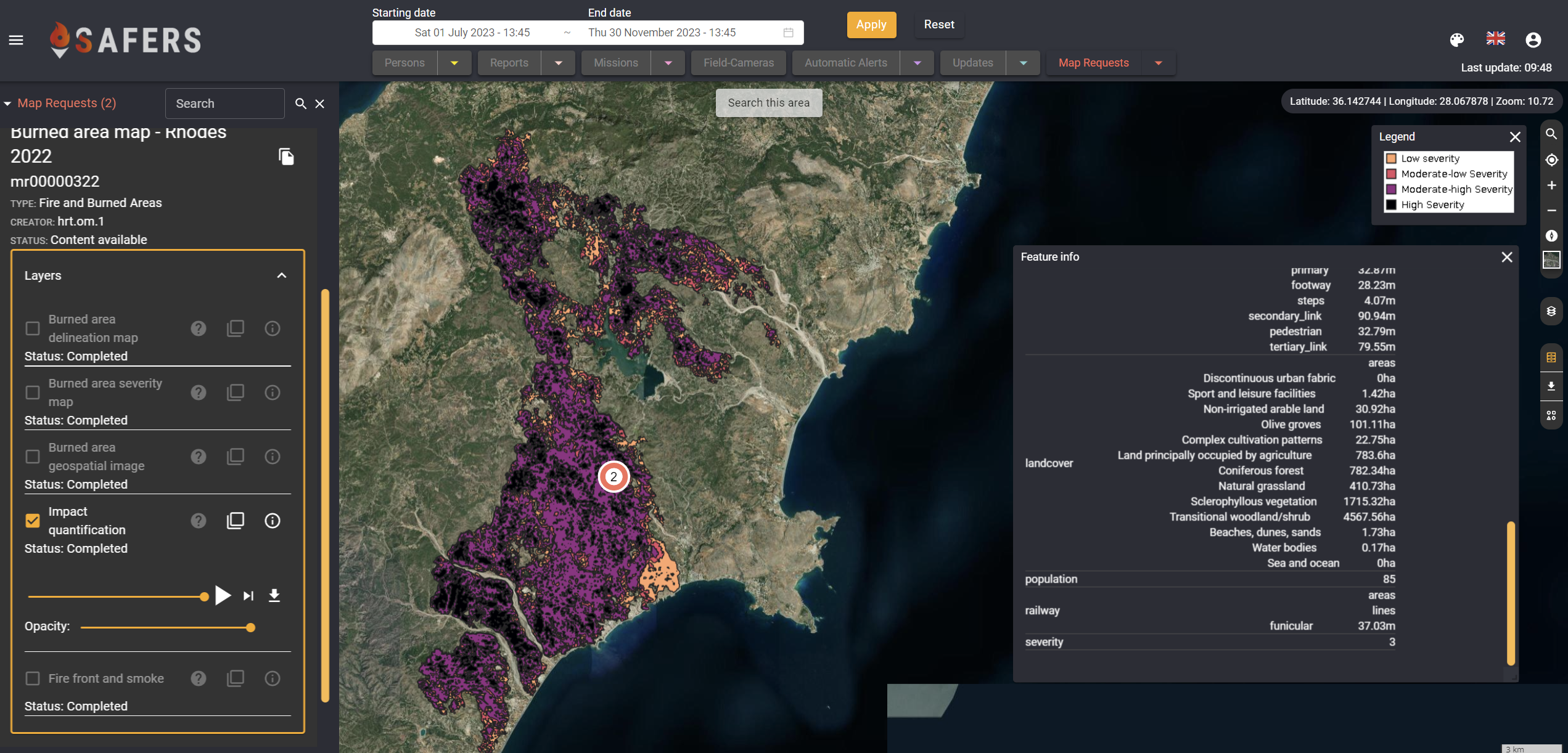
Imact estimation layer produced by the EO-based fire delineation and burnt area service