Targeted end-users
The intelligent SAFERS "OT-based post-fire monitoring" service uses satellite imagery from Copernicus Sentinel-2 satellites to provide past and present vegetation maps for monitoring and planning the restoration of burnt areas in a sustainable manner. The service provides on-demand data for monitoring post-fire recovery, planning climate change resilience initiatives and quantifying forest fuel regeneration. Key features include the use of Sentinel-2 imagery for automatic mapping of burnt areas and vegetation characterization using standard indices.
This service will offer continuous monitoring and reporting, enabling to support the reporting of Sustainable Development Goals (SDGs) and EU Green Deal targets; provide context to the development of post-wildfire recovery especially for Wildland-Urban Interface (WUI) planning; automate the monitoring of vegetation re-growth based on climate change resilience programs; and provides the quantification of forest fuel regeneration.
Wildfire management phase: adaptation and recovery.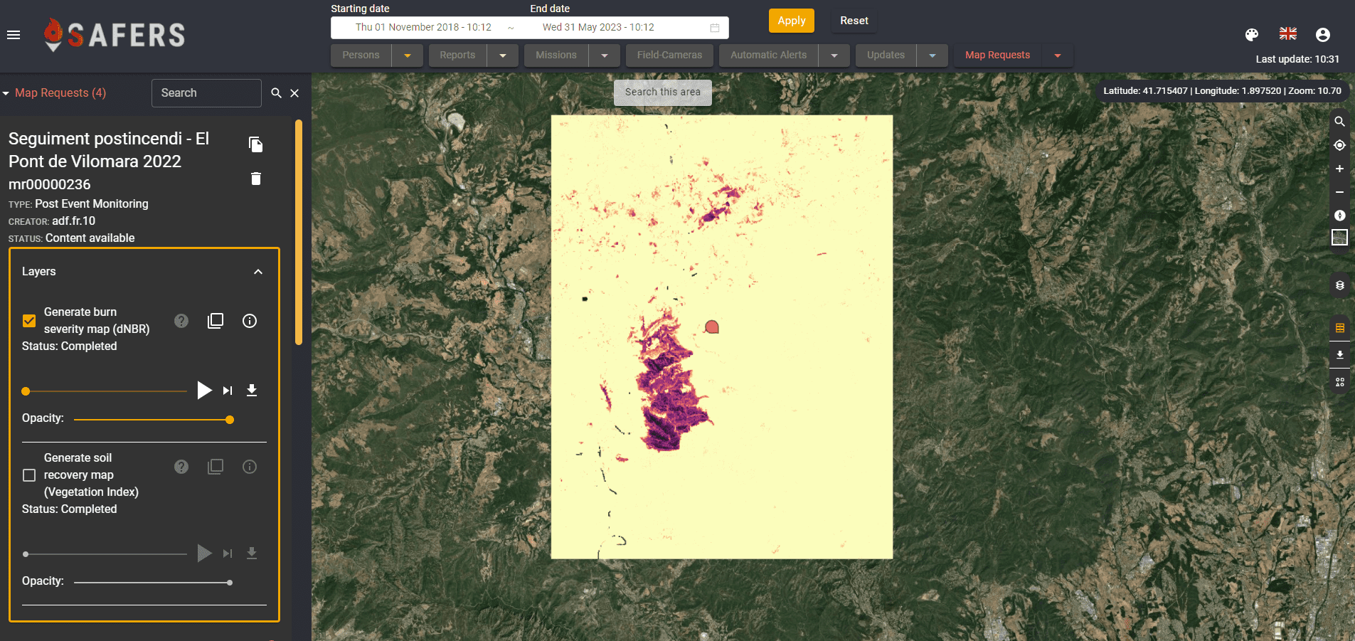 Post event monitoring (dNBR)
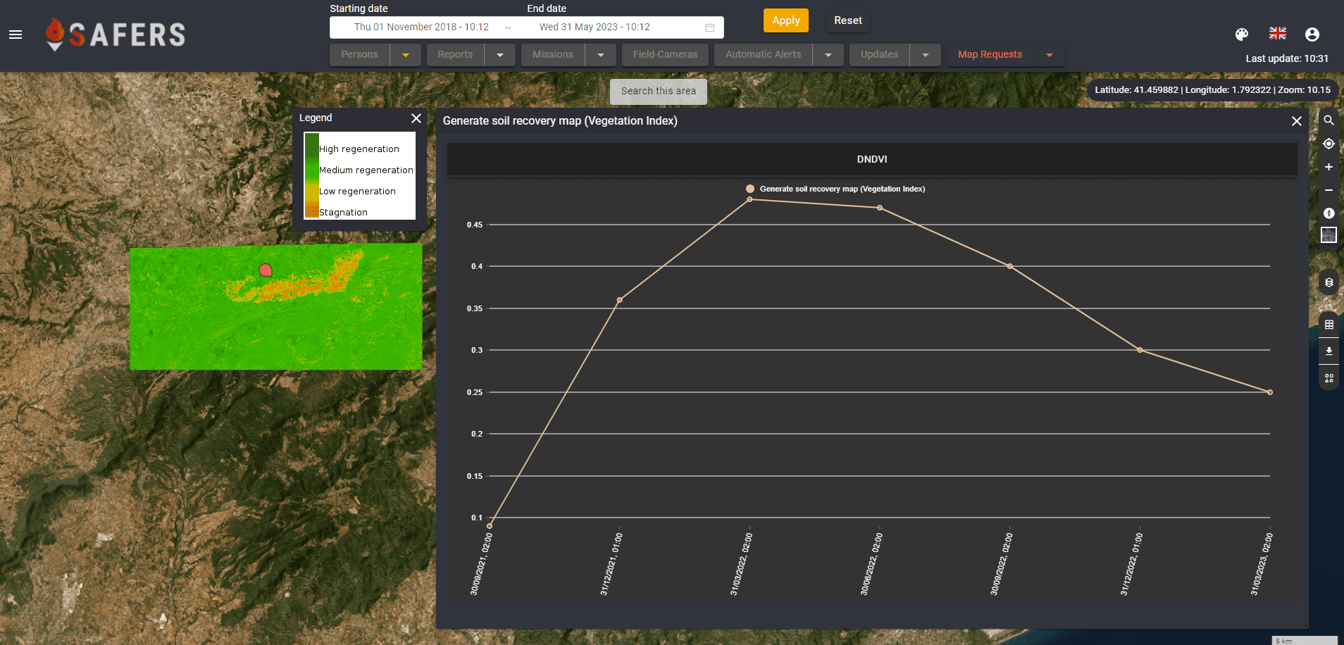
Post event monitoring (dNDVI)