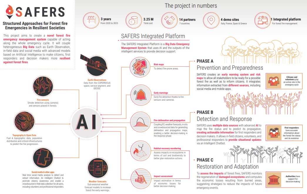
Targeted end-users
The SAFERS intelligent service "Sub-seasonal weather forecasts," developed in collaboration with the Finnish Meteorological Institute (FMI) and supported by RISC, is aimed primarily at the prevention, preparedness, and response phases of forest fire management. This service provides weather forecasts on different time scales to assess the risk of forest fires.
It offers medium-range weather forecast and Fire Weather Indices (up to 15 days): This service provides twice a day ensemble mean and 80% prediction interval of the ensemble forecast of relevant weather variables as well as Fire Weather Index, moisture codes and their anomalies using 40-year historical mean values. It allows the visualization over map and timeseries. These indices give information for awareness and early warning potential risk. Sub-seasonal forecast (up to 42 days): This service provides probabilistic forecasts of relevant weather variables up to 42 days. The product includes ensemble mean and 80% prediction interval and is updated twice per week. It allows the visualization over map and timeseries. These indices can be used in response-phase of forest fires which can be useful during the forest fire response phase. All this information is updated regularly and can be viewed on interactive maps, time series, with zoom and overlay options for greater awareness and early warning of potential forest fire risks.
The service involves statistical post-processing methods utilizing real-time and historical EO data, covering the whole sub-seasonal forecast scale that relevant to SAFERS for selected two pilot data sets provided by the European Centre for Medium-Range Weather Forecasts- ECMWF.
Wildfire management phase: prevention and preparedness; response phase.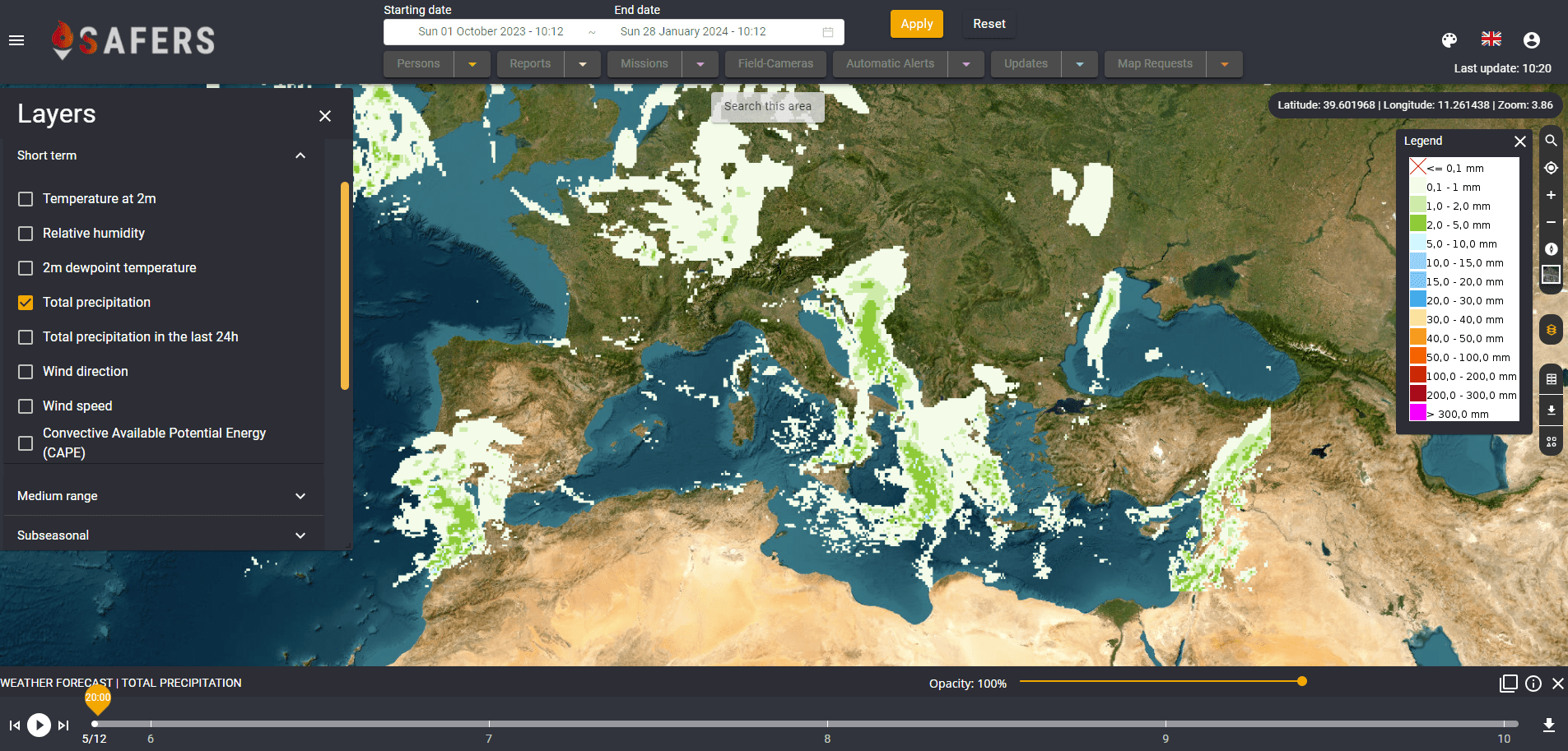
Short-term deterministic forecast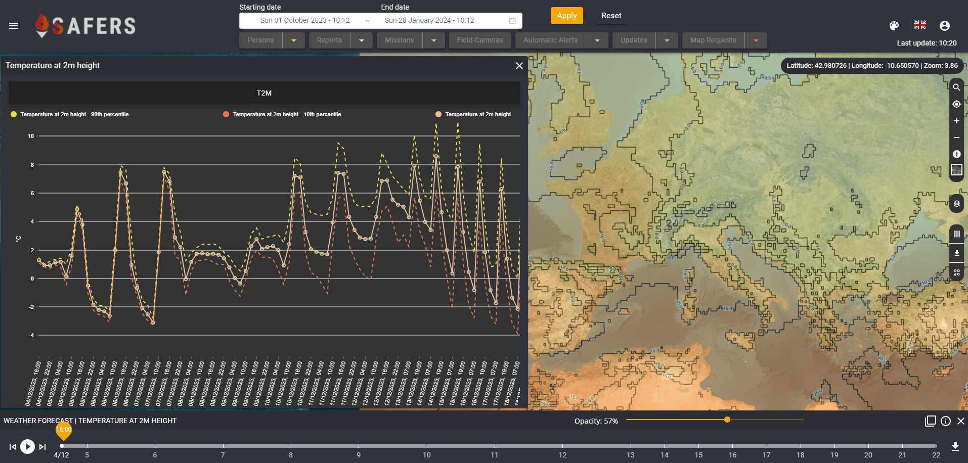
Medium-range probabilistic forecast